

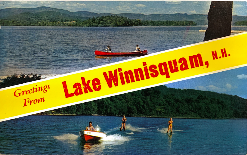
History of Lake Winnisquam


Photos credit: photos and postcards from Jim Chapman’s historical collection of Lake Winnisquam, unless otherwise noted.
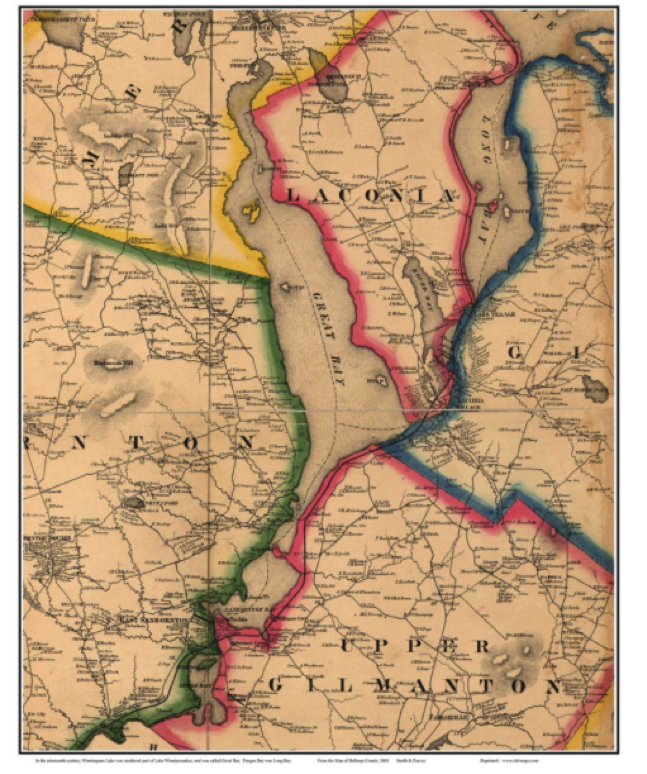
From the Map of Belknap County – 1860, Smith & Peavey
A HISTORY OF LAKE WINNISQUAM
Lake Winnisquam has a rich history that dates far back into the past. The lake was formed thousands of years ago by glacial activity when the glaciers that once covered North America retreated. Many Native American tribes resided in the Lakes Region of New Hampshire until the mid 1700s. The name Winnisquam is said to mean “pleasant waters” which is a fitting name for this beautiful lake.
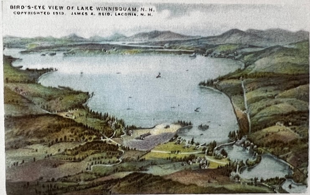
Until the late 1800s, Lake Winnisquam was considered to be part of Lake Winnipesaukee. Maps of Lake Winnisquam from the mid 1800s label the water body as “Great Bay”. At this time, several water bodies downstream of Winnipesaukee had other names. Paugus Bay was originally called Long Bay, followed by Lake Opechee, originally called Round Bay. Lake Winnisquam was originally called Great Bay, and the southern end of the lake from Mohawk Island to the lake’s outlet above Lochmere Dam was known as Middle Bay. Finally, Silver Lake was known as Little Bay or Lower Bay.
The Lakeport Dam was constructed on the Winnipesaukee River between what are now Lakes Opechee and Winnisquam in 1851 in order to provide power to the mills in the area. It is possible that the construction of this dam began to locally create the notion that Lake Winnipesaukee and Lake Winnisquam were two separate lakes. The first available map that labels Lake Winnisquam as its own entity is found in an 1892 atlas. So the change appears to have occurred sometime between 1860 and 1892.
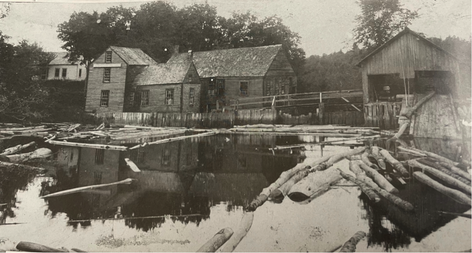
The Mills at Meredith Center - 1913 (Unknown Source)
The first official settlements and townships in the Lakes Region were recorded in the mid 1700s. During this time there was an increase in industry in the area as well, including blacksmiths, tanneries, gristmills, sawmills, etc. By 1795 there were sawmills in many locations including Meredith Center, Meredith Bridge, and Lake Village amongst others. The increase in industry in the Lakes Region during this time helped to develop the area and make it a desirable place for people to live and visit.
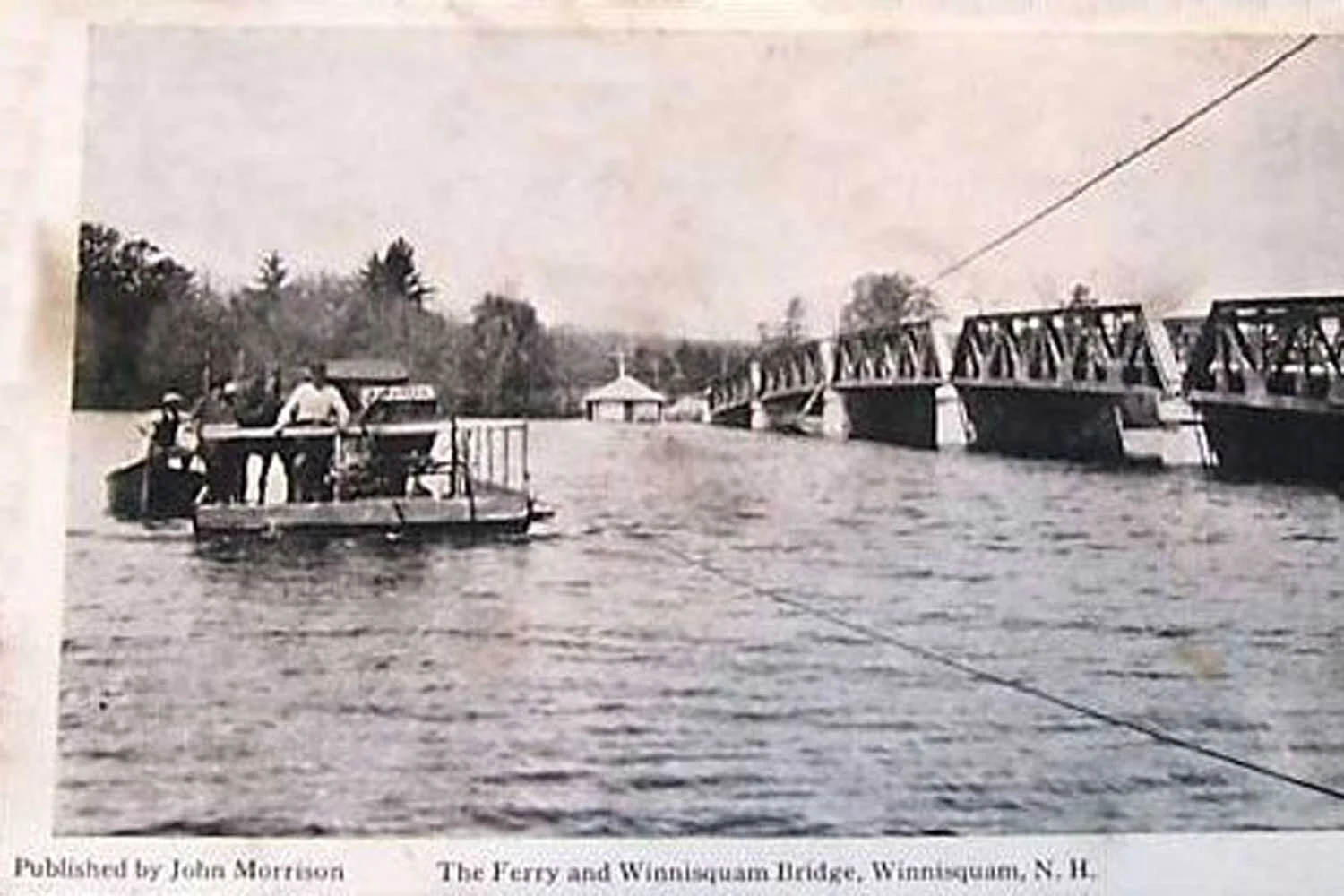
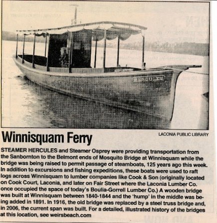
The second bridge to provide passage across the lake was the Sanbornton Bay Bridge built between 1840 and 1844, replacing the original wooden structure that was quite narrow and without railings. The new structure allowed for 2 wagons to pass and had three foot high railings. The local towns shared in the cost to build and maintain the bridge. Sanbornton and Tilton shared responsibility for the west side, and Belmont for the east side.
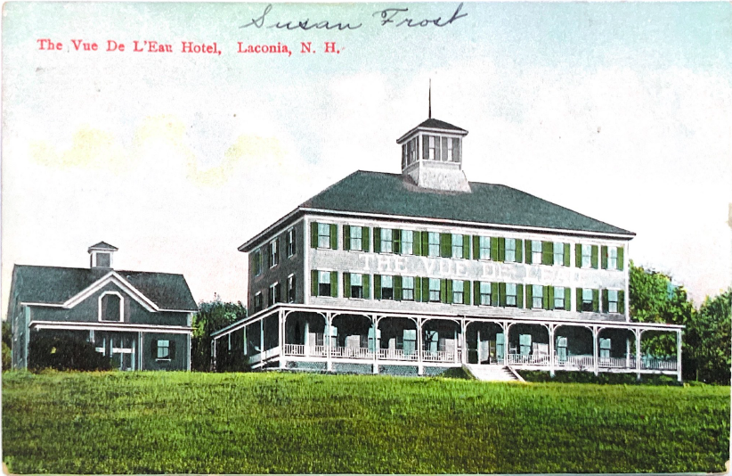
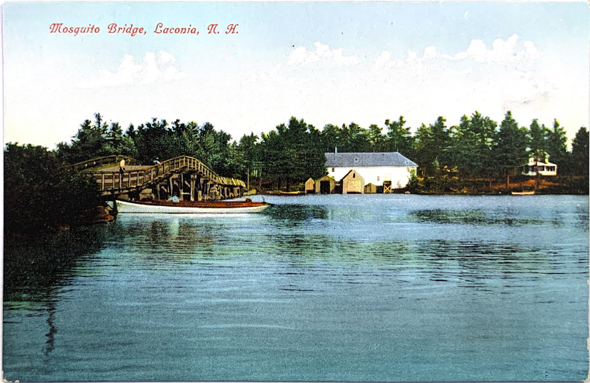
The most significant change that allowed the Lakes Region of New Hampshire to become the bustling recreation destination that it is today was the introduction of railways to the area in the 1800s. In August of 1848 the Boston, Concord and Montreal Railroad opened its route between Concord and Meredith Bridge, right along Lake Winnisquam. This route allowed travelers from other areas to visit New Hampshire’s Lakes Region and solidified the area as a vacation destination, increasing the economic development of the area. According to a family history by Wayne Snow, “Soon after, boarding houses began to spring up along the shores of Lake Winnisquam to accommodate summer guests. Then in the 1860s steamboats became popular for providing excursion trips for summer guests. About 1868 one steamboat owner, Herb Mann, who operated his vessel north of the Bay Bridge (as it was called at the time) because he could not get his steamboat under it, took action. The clearance under the bride was only five feet. So he went to the state legislature and it was decided the towns would have to modify the bridge to a clearance of eleven feet, a six foot high hump. Sanbornton was against the modification, forcing Tilton to solely support the rework project on the west side.”
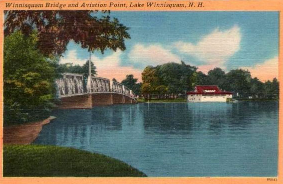
It was decided to build the hump nearer to the west side as it was not as deep as in the middle of the bridge. Wayne continues, “Tilton completed the job including raising the railings on the west side, but Belmont left the railings on the east side at the original level. With the hump much closer to the Tilton side, its raised profile formed the ‘nose’ of the mosquito and the Belmont side being low and a longer straight line to the eastern shore, it appeared like the ‘back’ of the mosquito.” Wayne includes the following: “From my extended research, this essay presents a plausible opinion of how the Winnisquam Bridge obtained its nickname.” The wooden bridge eventually collapsed and was replaced by a steel truss bridge in 1916. The current bridge was completed a little north of the previous bridges in 1974. The bridge is still known as Mosquito Bridge to this day.
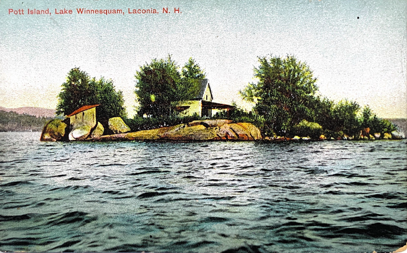
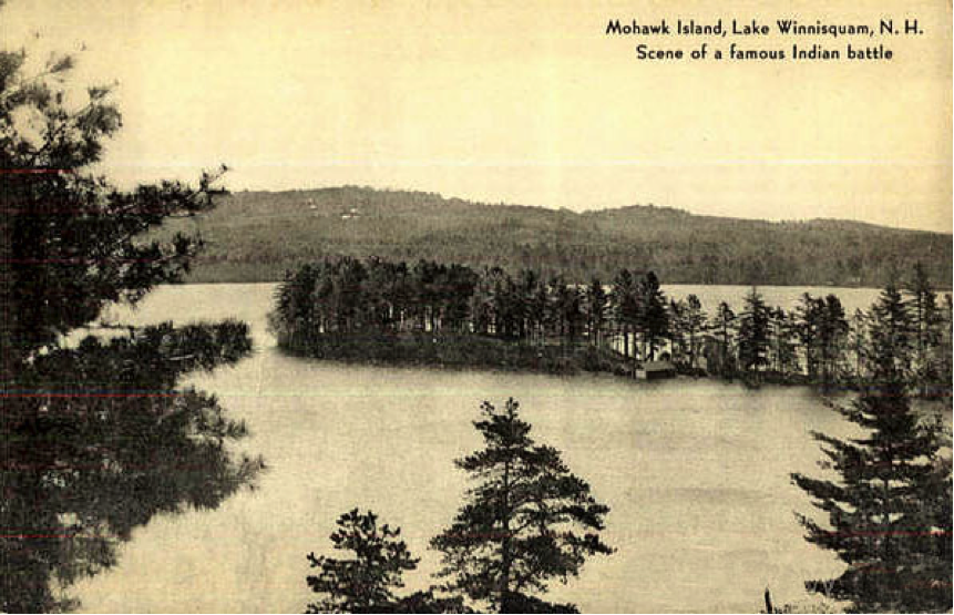
A notable feature of Lake Winnisquam are its islands, including Pot Island, Three Islands, Loon Island, Hog Island, and Mohawk Island. Mohawk Island was once a peninsula known as Mohawk Point. In 1910 the Lochmere dam was constructed, and the water level rose so much that the island became permanently separated from the land. Mohawk Island was given its name because it was the site of a famous battle in 1685 between Mohawk warriors and an alliance of Pennacook and Pequawket warriors. In this battle, the Mohawk warriors hid behind part of the peninsula and then ambushed their enemy, eventually leading to their victory.
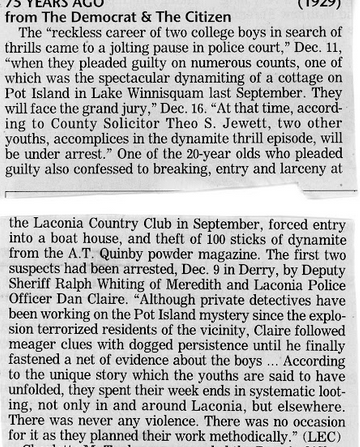
The story of Pot Island - According to local legend, in September 1929, a group of local youngsters got their hands on some of the dynamite that was being used to create new roads in the area. They rowed all of this dynamite out to Pot Island and set it to blow up the island. The culprits made it out alive, but only one fourth of the original Pot Island remains as a result of this explosion.
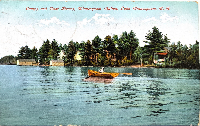
What is now known as Waldron Bay, a lakeside community in the town of Meredith, was once Camp Waldron, a boy’s camp on the shore of the lake. The camp was run by the Boston Missionary School Society, which owned an extensive amount of land along the northwest side of Lake Winnisquam. They also operated a girl’s camp on the north side of the cove. These camps were created to provide outdoor opportunities to poor children from the Boston area. The camp was operational from the early 1900s until the 1970s. Waldron Bay is now a beautiful lakeside community that includes a private beach and many acres of conserved woods.
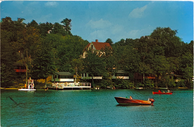
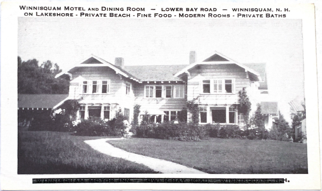
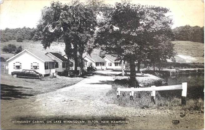
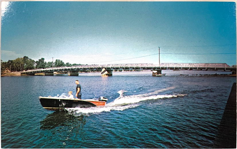
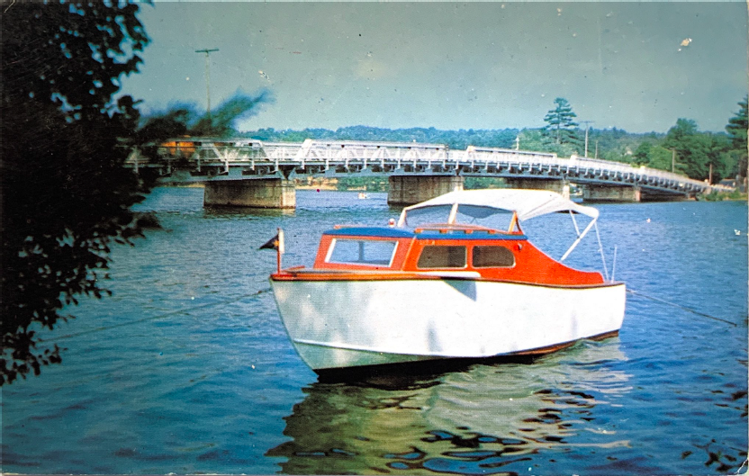
Many of the residences along the shores of Lake Winnisquam were once primitive camps with no electricity or running water. In the 1950s and 1960s many of these homes were converted into cottages with plumbing and running water, and the development of the shoreline began to take off. In the early 1980s motorboats became popular and lakefront properties were in high demand. Since then, the development along the shoreline of the lake has continued to increase as people purchase their second homes to spend more time in the beautiful Lakes Region of New Hampshire.
Though Lake Winnisquam is now known for its excellent water quality, this has not always been the case in the past. In 1952, the city of Laconia’s primary water treatment plant was built, and it began dumping all of its effluent into Lake Winnisquam. This dumping of untreated effluent into the lake became a much larger problem as smaller camps were being converted into larger, more permanent homes and the shoreline of the lake became more developed. The water quality of Lake Winnisquam became so bad that harmful algal blooms became common throughout the 1950s and 1960s, and the lake struggled to sustain aquatic life. In 1969, the Lakes Region Clean Waters Association (see video below) was formed with the intent to find a solution to this problem. Through many years of persistent grassroots efforts from local community members a one-million-dollar grant was secured from the EPA through the newly passed Clean Water Act to address this issue. In 1976 the Winnipesaukee River Basin, a state-owned sewer system, was able to take control of the sewage for multiple towns in the watershed. The Winnipesaukee River Basin’s water treatment plant in Franklin, NH was the first regional treatment plant funded under the Clean Water Act/Construction Grants program. This effort by the Lakes Region Clean Waters Association is a good example of how local community action can really make a large-scale difference in our environment.

Now, as development along the shoreline of Lake Winnisquam continues to increase, it’s important to ensure we maintain the water quality of the lake that was fought so hard for. This is why the Winnisquam Watershed Network works to preserve water quality and conserve land within the watershed so future generations may continue to enjoy and love Lake Winnisquam, its wildlife, and maybe even catch the big one some day.
CLEARING THE WATER
Watch the story of the Lakes Region Clean Waters Association founded in 1969, one of the early leaders in the movement for a cleaner environment. Their successful efforts to clean up New Hampshire’s Lake Winnisquam not only allow us to enjoy what the lake is today, they also helped set the tone for the newly created Environmental Protection Agency. The Agency presented the Association with the first EPA Environmental Protection Award in 1975.
You can also read a local resident’s story on the history of Lake Winnisquam from 1932 to 1994, about the North West side of the lake, Black Brook Road, as she told it to her lake association neighbors back in 1995.