
Watershed Protection in Action
Protecting Lake Winnisquam: The Watershed-Based Plan
Lake Winnisquam remains a high-quality lake, but is increasingly affected by sediment and nutrient loading from the surrounding watershed. Sediment carries phosphorus - a key nutrient that can fuel excessive plant and algae growth and contribute to cyanobacteria blooms, which have increased in recent years.
To address these challenges, the Lake Winnisquam Watershed-Based Plan was completed in July 2022. The plan provides a long-term roadmap for protecting water quality and identifies more than 100 sources of non-point pollution across the watershed.
Primary phosphorus sources include:
Unpaved road and ditch erosion
Waterfront park and beach erosion
Shoreline buffer clearing
Untreated urban stormwater runoff
Key recommendations include:
Structural Best Management Practices (BMPs) at priority sites
Long-term water quality monitoring
Expanded education and outreach
Stronger local ordinances
Improved municipal road maintenance practices
Stream restoration
Land conservation and protection of critical areas
From Plan to Action: Watershed Implementation Projects
Following completion of the Watershed-Based Plan, the Winnisquam Watershed Network (WWN) launched the first phase of implementation projects to address key pollution sources identified in the plan.
Three high-priority sites were selected for stormwater improvements:
Gale Avenue Park (Laconia)
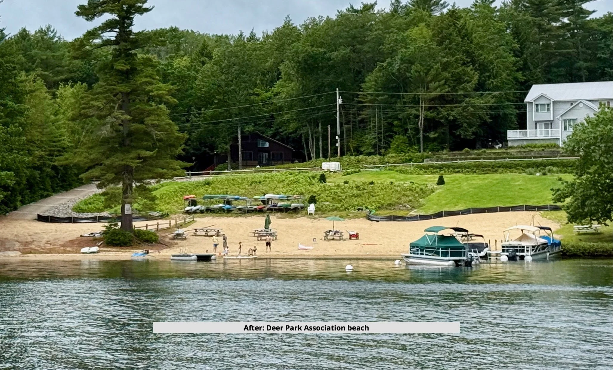
Deer Park Association Beach (Meredith)
Kaulback Road (Sanbornton)
These projects focused on installing structural BMPs to reduce sediment and nutrient runoff and improve stormwater management at the source.
Funding was provided in part through a $125,000 Watershed Assistance Grant from the New Hampshire Department of Environmental Services, supported by Clean Water Act Section 319 funds from the U.S. Environmental Protection Agency.
WWN engaged Comprehensive Environmental, Inc. (CEI) to complete site assessments, engineering design, and permitting. All three projects were developed in close collaboration with local partners.
Together, these projects are expected to reduce phosphorus-laden sediment entering Lake Winnisquam by approximately 8 tons per year.
Project Highlights
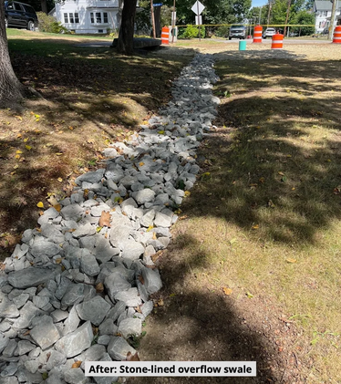
Gale Avenue Park (Laconia)
Stormwater runoff from surrounding roadways had created erosion channels through this public park and contributed sediment and phosphorus to the lake. The project included:
Sediment forebay
Biofiltration basin (rain garden)
Gravel-lined overflow channel
Vegetated swale
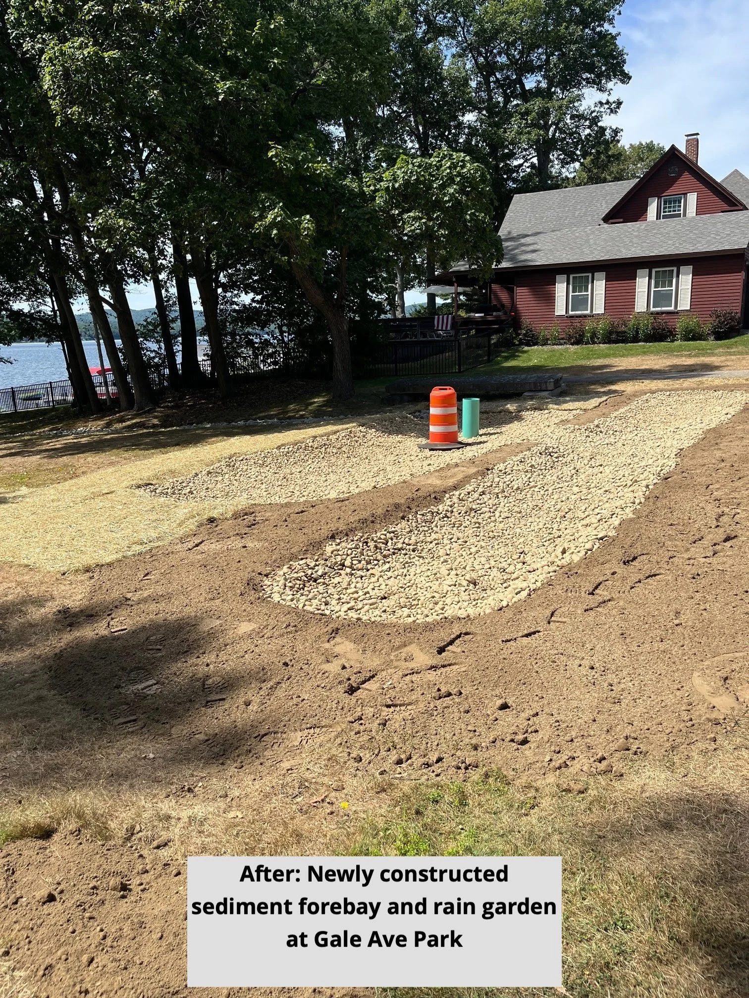
Construction was completed in August 2025 by the Laconia Department of Public Works and Recreation Department, with planting and long-term maintenance led by the Laconia Conservation Commission.
On June 4, 2026 the WWN welcomed municipal staff, conservation leaders, lake association members, and watershed stakeholders to the Gale Avenue Best Management Practice (BMP) Site Tour in Laconia. The event provided an opportunity to showcase a successful stormwater improvement project and highlight the partnerships that make watershed protection possible.
This project serves as an excellent example of how collaborative efforts can address stormwater runoff while enhancing public spaces. Stormwater runoff remains one of the most significant sources of pollution entering Lake Winnisquam and its tributaries. By implementing targeted BMPs, communities can reduce sediment, phosphorus, and other pollutants before they reach local waterways.
Gale Ave BMP Site Tour
Gale Ave BMP Site Tour
Kaulback Road (Sanbornton)
This project addressed erosion along an unpaved road crossing Black Brook, a tributary to Lake Winnisquam. Erosion near culverts was transporting sediment directly into the brook. Improvements included:
Installation of sediment traps
Stormwater diversions to adjacent upland areas
Upgrades to existing erosion control structures
The project was constructed in the fall of 2024 by the Sanbornton Highway Department.
Kaulback Road with sediment runoff heading to Black Brook
Kaulback Road after, with sediment trap in place
Deer Park Association Beach (Meredith)
This project focused on reducing runoff from a steep unpaved driveway and adjacent shoreline area. Key features include:
Sediment forebay to capture runoff
Stone-lined drainage swale
Water bars to redirect stormwater
Bioretention (rain garden) basin
Regrading and revegetation of eroded slopes
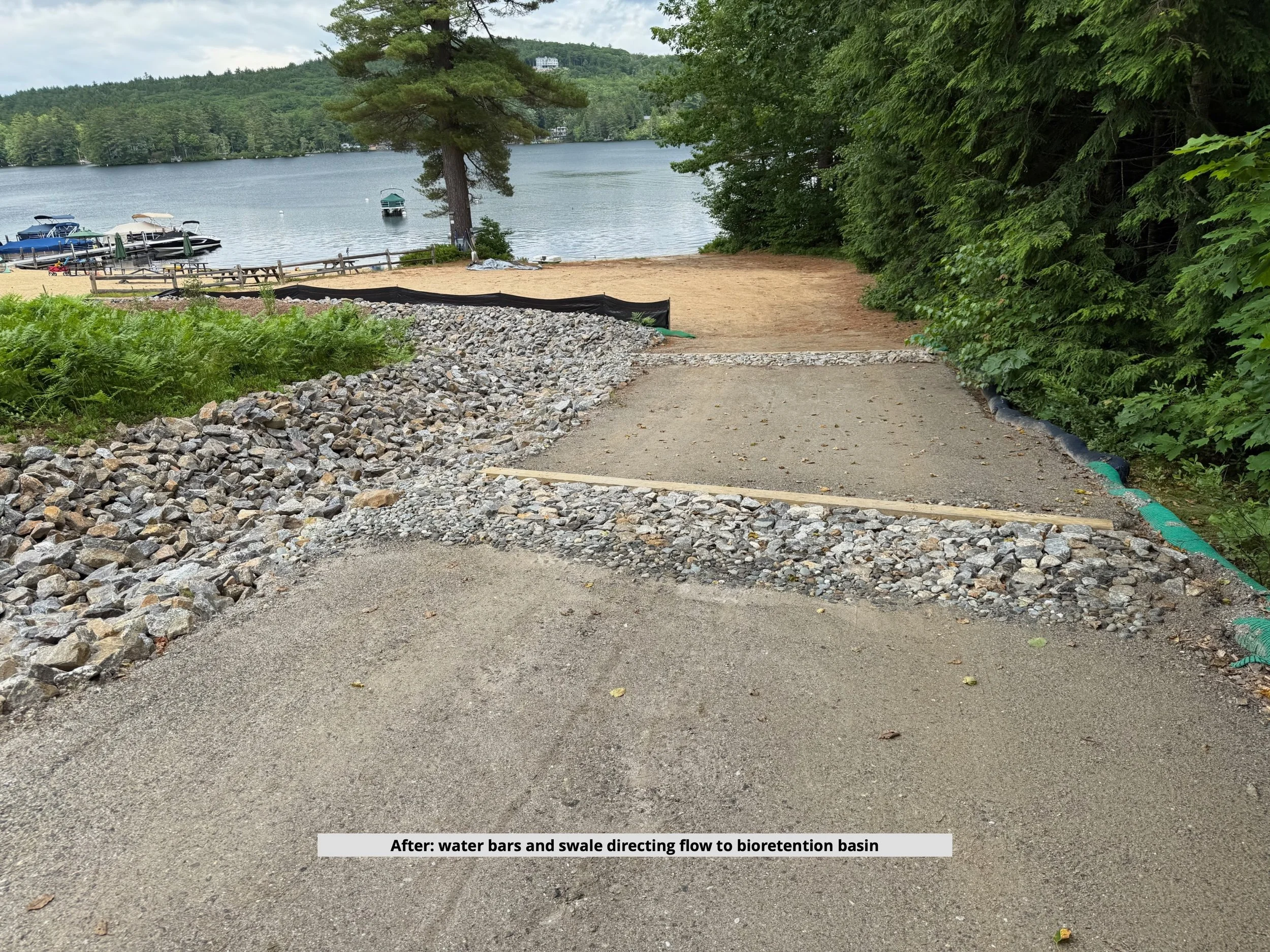
Construction was completed by Total Grounds Landscape Inc. in the spring of 2025. Deer Park Association residents contributed volunteer labor, ongoing maintenance, and equipment as part of the project’s matching funds.
The Power of Partnership
These projects demonstrate the importance of collaboration and partnerships. Successful watershed projects that benefit both the environment and the community require coordination among local governments, state agencies, homeowner associations, engineers, contractors, volunteers, and nonprofit organizations. By working together, these partners have already made measurable progress in protecting Lake Winnisquam and are helping ensure a healthier lake for future generations.
WWN extends its sincere appreciation to our project partners, including the New Hampshire Department of Environmental Services (NHDES), the City of Laconia Parks and Recreation Department, the Laconia Department of Public Works, the Laconia Conservation Commission, the town of Sanbornton, the Sanbornton Highway Department, the Deer Park Association, Total Grounds Landscape, and CEI Engineers.
With these three projects now finished, WWN is continuing to advance additional recommendations outlined in the Watershed-Based Plan—building on this momentum to further reduce pollution and improve lake health. For information on what you can do to help, please visit NH Lakes LakeSmart Tips forLake Friendly Living.
What You Can Do
Every property owner in the watershed plays a role in protecting Lake Winnisquam. You can help by:
Maintaining or restoring natural vegetation along shorelines and waterways
Reducing fertilizer use near the lake and streams
Managing stormwater on your property with rain gardens or infiltration areas
Keeping leaves, grass clippings, and debris out of roads and ditches
Supporting local conservation and water quality initiatives
Maintaining septic systems properly
Small actions across the watershed add up to meaningful protection for the lake we all share.For more information: